SAN FRANCISCO - YOSEMITE - HAWAII
HONOLULU - WAIKIKI
HONOLULU - WAIKIKI
Researched and written by George W. Randall Research, co-founder in 1996 and former Vice Chairman Kinloch Castle Friends' Association.


>< + >< + >< + ><>< + >< + >< + >< >< + >< + >< + ><>< + >< + >< + ><


HOWEVER


THANK YOU!
+
WORLD TOUR 1892-1895 of GEORGE
BULLOUGH

ALBUM XIX CONTAINS 32 PHOTOGRAPHS
all of which are reproduced here as first generation copies by George W. Randall.
Photographs 10 - 32 are identified as being the work of Isaiah
West Taber,
West Coast America’s leading photographer in the late 19th century.
West Coast America’s leading photographer in the late 19th century.

>>>>>>>
<<<<<<<
* >>>>>>>
<<<<<<<

 George
Bullough (right) was twenty-two years old when he embarked
George
Bullough (right) was twenty-two years old when he embarked
on a three year long world
tour with his travelling companion,
Robert Mitchell, in September 1892.
Bullough’s
father, John, owner of Howard & Bullough, Ltd., cotton machinery
manufacturers, Accrington, England, died on the 25th of
March the previous year, three days short of George’s coming of
age, leaving his eldest son a very wealthy young man.
The world
they travelled was a car free world, a very different world,
a world
now beyond living memory, a world at the very height of the Victorian Era .....

In 1896
Robert Mitchell recalled their experiences in a series of twenty-eight
articles published in the weekly Accrington Division Gazette, photo-copies of
which
were made
available to me by Accrington Library and each of which I
transcribed
unaltered and illustrated from my copies of the twenty volume
collection of photographs they brought back.
Regrettably the articles only cover the first half of their global tour, ending
with their visit down a diamond mine near Johannesburg in October 1893.
Photograph Album XIX contains thirty-two images commencing in Hawaii
and concluding with the
magnificent “twenty-seven foot diameter Virginia
and Maryland (giant sequoia) Mariposa Grove”
in California’s Yosemite National Park.
The photographs are reproduced from my collection of first generation copies
from Mr. Bullough's originals. Each minimal title is as ascribed by Mr. Bullough.
Descriptive text researched and written by George W. Randall.
>>>>>>> <<<<<<< * >>>>>>> <<<<<<<
HAWAII
HAWAII


HONOLULU

HAWAIIAN HOTEL, HONOLULU
Album XIX * Image
1 * Size 9½ x 7 inches

The Hawaiian
Hotel, on the island of Oahu, was located on Richard Street,
Honolulu, the
State Capital.

HAWAIIAN HOTEL, HONOLULU
Album XIX * Image 1 * Edited from full size 9½ x 7 inches.

Despite much opposition - “the project being either the product of an impracticable visionary
or a cunningly contrived scheme for the personal aggrandizement of somebody,
and erection of a fine roomy government house”, ...... .....
“the four hundred rooms unlikely to be filled”,
to the scheme being “a large blunder ... ” - a site on the corner of Richard Street
to the scheme being “a large blunder ... ” - a site on the corner of Richard Street
and Hotel Street was purchased and the hotel built at a cost of $116,528.
who operated it for two terms of five years until 1882.
It was not until the mid-1880’s that occupancy exceeded capacity at which time twenty
guest cottages were added to the four acre site and the complex renamed,
The Royal Hawaiian Hotel.
it was “the place to stay” in Honolulu.
operated as a YMCA until 1926 when it too was demolished.

>>>>>>> <<<<<<< * >>>>>>> <<<<<<<
FORT STREET, HONOLULU


John
Lewis, son of Isaiah and Polly (Holmes) Lewis, was born in Hawaii, he was the proprietor of Lewis & Co., Lld,. successful dry goods importing merchant in Honolulu.

>< >< >< >< >< >< >< >< >< >< >< >< >< >< >< >< ><

SURF RIDING, WAIKIKI
Album XIX *
Image 3 * Size 9¼ x 7½ inches
(Note: Images 3 and 4 are on the same page in Album XIX)
Photographed against
the backdrop of Diamond Head, Hawaii’s 762 foot iconic extinct volcano,
canoe surf
riding on Waikiki Beach, though at the time not as popular as with a surf
board,
“required dexterous skill and strength to avoid disastrous results.”
The canoe would be paddled out to the line of breakers. Take position and wait for an approaching ohu (wave) and paddle quickly until the swell of the cresting surf seized their boat and drove it beach-ward without the aid of paddles other than the steersman to guide it straight
“but woe be it if his paddle should get displaced.”
Ref: Thrum’s
Hawaiian Almanac – Surf Riding Culture.

>< >< >< >< >< >< >< >< * >< >< >< >< >< >< >< ><

SURF RIDING, WAIKIKI
Album XIX * Image 3 * Detail from full size 9¼ x 7½ inches
Album XIX * Image 3 * Detail from full size 9¼ x 7½ inches
>< >< >< >< >< >< >< >< * >< >< >< >< >< >< >< ><

SURF RIDING, WAIKIKI
Album
XIX * Image 4 * Size 9½ x 7½ inches
(Note: Images 3 and 4
are on the same page in Album XIX)

>< >< >< >< >< >< >< >< >< >< >< >< >< >< >< >< ><

HULA GIRLS (No. 70)
Album XIX *
Image 6 * Detail from full size 9 x 7½ inches
Full
of rhythm, grace, sensuality and always done bare-foot Hula dancing was brought
to Hawaii by
Polynesian settlers where it became part of religious ceremonies.
Carried out
by both sexes it
is today often performed at blessings and celebrations,
a visit to Hawaii would
be incomplete without enjoying, even participating in a hula dance.
>< >< >< >< >< >< >< >< >< >< >< >< >< >< >< >< ><

NATIVE HULA DANCE
Album XIX *
Image 7 * Size 9½ x 7 inches

Hawaii Hula Company - https://hawaiihulacompany.com
>< >< >< >< >< >< >< >< >< >< >< >< >< >< >< >< ><


The
“Native Rider” is a Pa’u* Rider,
a wahine, Hawaiian for a woman horseback
who wears a long, colourful skirt (to protect
her legs when riding) and rides side-saddle
rather than astride.
a wahine, Hawaiian for a woman horseback
who wears a long, colourful skirt (to protect
her legs when riding) and rides side-saddle
rather than astride.
It
was Captain Richard J. Cleveland,
first cousin to William Cleveland grandfather
of U.S. President Grover Cleveland and
master of the 175 ton berthen brig “Leila Byrd”
who introduced horses to Hawaii in 1803.
first cousin to William Cleveland grandfather
of U.S. President Grover Cleveland and
master of the 175 ton berthen brig “Leila Byrd”
who introduced horses to Hawaii in 1803.
Sixty-seven
year old Kamehameha,
King
of Hawaii, apparently
“disliked
the creatures, partially on account
of the amount of food they required.”
of the amount of food they required.”
Western
sailors however took full advantage
and
enthusiastically rode the horses along the
golden beaches. It was not long
before the native
men and women took to horse riding thereby establishing the
long Hawaiian equestrian
relationship which today includes cowboy
riding, (a skill they learnt from Mexican
livestock herders), known as paniolo believed to originate from the Hawaiian words for
riding, (a skill they learnt from Mexican
livestock herders), known as paniolo believed to originate from the Hawaiian words for
“hold firmly and sway gracefully.”
After
a brief decline riding was given new impetus in 1906 by Lizzie K. Puahi at her home, near Waikiki with the establishment of official riding schools, monthly meetings
which attracted women who practiced equestrianism becoming
known as the Pa’u
Riders Club.
* The word pa’u means skirt in the Hawaiian language.
* The word pa’u means skirt in the Hawaiian language.
>< >< >< >< >< >< >< >< >< >< >< >< >< >< >< >< ><

TARO PLANT USED AS FOOD
Album XIX * Image 9 * Size 9¼ x 7 inches
Album XIX * Image 9 * Size 9¼ x 7 inches
Taro (Colocasia esculenta) is a perennial root vegetable with broad heart-shape leaves.
It is believed to
have originated from Southern India many centuries ago and brought
to the
Hawaiian Islands by Polynesians. It is low in fat, high in vitamin A (for
growth and development, maintenance of the immune system and vital for eyesight),
and full of complex carbohydrates essential for the body to function well.
The
corm, (underground plant stem) is first cooked and then mashed at which time
it
is called pa’i ‘ai, being starchy and having the
consistency of dough.
Water is added during further mashing and again prior to
eating in order to achieve the desired consistency. Depending on the resulting “thickness”
the resulting Poi is classified as “one
finger”, “two finger” or “three finger” referring to how many fingers are
required to scoop it up;
the thicker the Poi
the fewer the fingers.
Highly
nutritious, Poi can be eaten
immediately when it is sweet,
or left to ferment after which it becomes
increasingly sour.
Today, Nigeria is the world's largest producer of taro at 3,637,627 tons per year.
(2,240-lbs. = 1 ton)
(2,240-lbs. = 1 ton)
<> <> <> <> <> <> <> <> <> <> <><> <> <> <> <> <> <> <> <> <> <>
CALIFORNIA
San Francisco

 |
| Map from Encyclopædia Britannica Ninth Edition 1892. |
The Encyclopædia Britannica of 1892
describes San Francisco as the largest commercial city of California.
Census returns for 1850 put the population at 34,000, and 1880 at 233,959, breaking that down into 132,608 males and 101,351 females. “In social customs, trade usages, amusements and religious observances, the large foreign population contributes materially to the formation of its liberal and cosmopolitan characteur.” (San Francisco population today - 2019 - almost 880,000.)
“In the first
stages of its history buildings were chiefly of wood, in many cases the frames
and coverings having being brought from the Atlantic States round Cape Horn.
Within a few months
of the establishment of municipal government the city
suffered severely from fire.
The fire of the 4th of May 1850 destroyed property to the value of $3 million equal to
almost $100 million in 2019. (Reference: official data.org). An even more destructive fire
The fire of the 4th of May 1850 destroyed property to the value of $3 million equal to
almost $100 million in 2019. (Reference: official data.org). An even more destructive fire
the
following month caused $4 million of damage, while a third in September the
same year
caused half a million dollars’ worth of damage.
These occurrences naturally led to the employment of more substantial building material, in some cases granite being imported from China!
caused half a million dollars’ worth of damage.
These occurrences naturally led to the employment of more substantial building material, in some cases granite being imported from China!
Other buildings utilised brick and
iron, but even so in 1892 nearly all the private dwellings
were of wood,
principally red wood instead of pine.
The Bay of San
Francisco extends past the city in a south-south-east direction for about
forty
miles, varying in width between seven and twelve miles.
A three mile straight to the north leads to San Pablo Bay, ten miles in length
and breadth having at its extremity the site of a navy yard (at Mare Island,
the first United States Navy base on the Pacific Ocean coast).
The principal islands in the Bay are Alcatraz, 30 acres and Goat Island extending to 300 acres.”
The following 23 photographs are identified as being taken by San Francisco photographer,
Isaiah West Taber

THE ORIGINAL PHOTOGRAPHER
Isaiah West Taber
THE ORIGINAL PHOTOGRAPHER

Isaiah West Taber was born on the 17th of August 1830
in New Bedford, Massachusetts, where for almost five years, from age fifteen, he worked on whaling ships
in the North Pacific Ocean.
In 1850 he joined a Gold Rush party and moved to California, where, before returning east four years later
he apparently "made money by selling a thousand pigs
he had purchased in the Marquesas Islands."
Back east in 1854 he worked as a sketch artist and, after studying dentistry opened a dental practice.
He developed a keen interest in the emerging
daguerreotype photographic process, later opening his first photographic studio at Syracuse, New York State in partnership with his younger brother,
Freeman Augustus Taber.

In 1864, following an invitation from leading photographers on America’s West Coast,
Henry William Bradley and William Herman Rulofson, Taber sold his Syracuse business
to George K. Knapp & Co., and returned to California working for
Bradley and Rulofson in their San Francisco studio at 429, Montgomery Street.
In 1871 he bought the business of local competitor, Charles and Hugo Nahl, Art and Photographic Gallery, in Montgomery Street, establishing his own photography business and gallery at No.8, Montgomery Street, San Francisco, where his work quickly gained recognition.
Following the misfortunes resulting in foreclosure of American photographer
Carleton E. Watkins, (1829-1916), Taber purchased his studio and entire inventory,
including images of Yosemite Valley.
He reproduced Watkins' Yosemite photographs which significantly influenced the
States Congress to designate the area a National Park encompassing
almost 750,000 acres in October 1890.
By the late 1870's Isiah Taber's business was by far the most successful on America's West Coast. In 1880 Taber made a six-week photographic tour of the Hawaiian Islands and later California, twenty-three of these photographs are identified as such in Album Nineteen recording George Bullough and Robert Mitchell’s World Tour 1892-1895.
By the 1890’s
Taber had established himself as California's leading
photographer
and
ambrotypist,* his business having expanded to include studios in several
in European cities
and London (England) at Station Buildings, Acton Street,
Hackney, under the name of
the Taber Bas Relief Photographic Syndicate.
the Taber Bas Relief Photographic Syndicate.
Awarded the
photographic concession at the first San Francisco Midwinter International Exposition held 1893/1894 in Golden Gate Park, three
years later Taber travelled to London
to photograph the pageantry of Queen
Victoria’s Jubilee
followed by a commission to photograph the Prince of Wales,
later King Edward VII.
Isaiah Taber was seventy-six years old when the San Francisco earthquake and subsequent
devastating fire of 1906 destroyed his studio, entire stock of glass plates and career!
devastating fire of 1906 destroyed his studio, entire stock of glass plates and career!
Fortunately he donated copies of his work to California State Library “that the state may
preserve the names and faces, and keep alive the memory of those who made it what it is.”
preserve the names and faces, and keep alive the memory of those who made it what it is.”
Isaiah West Taber died of heart failure on the 22nd of February 1912 in his eighty-second year.


* Ambrotypist: a
positive photograph on glass utilising the collodion process.
REFERENCE:
“Pioneer
Photographers of the Far West: A Biographical Dictionary 1840-1865”
by
Peter E. Palmquist and Thomas R. Kailbourn - Published 2000
I. W. Taber at Historic Camera (Google)
I. W. Taber at Historic Camera (Google)


<> <> <> <> <> <> <> <> <> <> <> * <> <> <> <> <> <> <> <> <> <> <>

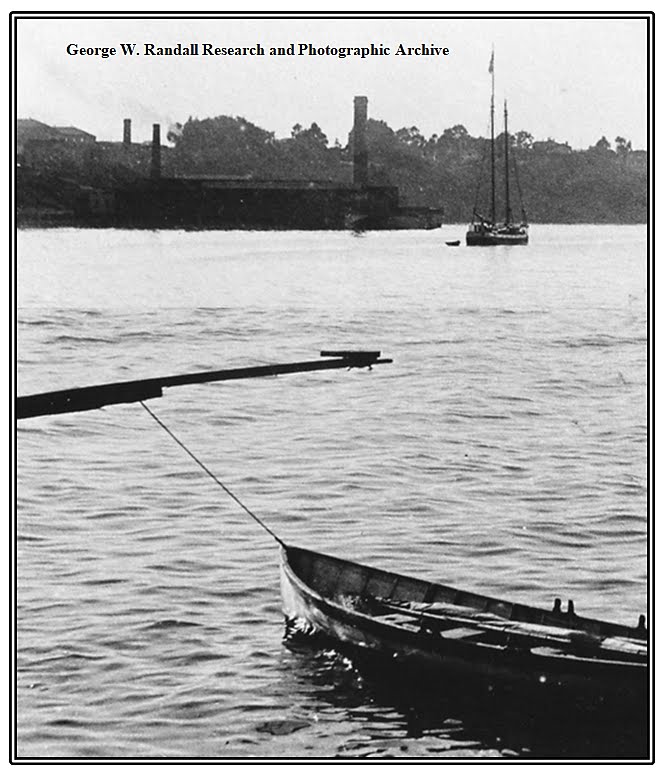
GOLDEN GATE AND BLACK POINT
Via Pacific Coast Steamship Co’s Line
Album XIX *
Image 10 * Size 9½ x 7½ inches
Original photograph by Taber, San Francisco Number 5721
Golden
Gate is the name given to the one mile wide entrance to San Francisco Bay from
the Pacific Ocean. It was not until the 27th of May 1937 the almost
9,000 foot long Golden Gate suspension bridge linking the distant opposing headlands
was opened.


GOLDEN GATE AND BLACK POINT
Via Pacific Coast Steamship Co’s Line
Album XIX * Image 10
Detail from full size 9½ x 7½ inches
Original photograph by Taber, San Francisco Number 5721

Via Pacific Coast Steamship Co’s Line
Album XIX * Image 10
Detail from full size 9½ x 7½ inches
Original photograph by Taber, San Francisco Number 5721

With headquarters in San Francisco The Pacific Coast Steamship Company was
incorporated on the 17th of October 1876 out of the
Goodall, Nelson & Perkins Steamship Company itself founded in 1867.
The new company owned most of the coastal shipping of the day
including passenger travel
with tickets being sold at its Palace Hotel Montgomery
Street, San Francisco, office.
GOLDEN GATE AND BLACK POINT
Via Pacific Coast Steamship Co’s Line
Album XIX * Image 10 * Detail from full size 9½ x 7½ inches
Original photograph by Taber, San Francisco Number 5721

smelter of Thomas Henry Selby, 1820-1875, founded in 1865.
Selby, an 1849 California
Gold Rush immigrant from New York, was the thirteenth mayor of
San Francisco
serving a two year term from December 1869 to 1871.
 |
| From: San Francisco - The Imperial City 1899 |
founded by Spanish colonists as
Presido of San Francisco on the southern shore of the Golden Gate in June 1776 and a “boom town” due to the Gold Rush 1848-1855.
In
1854 Selby was advertising as
“Thomas H. Selby & Company,
Importers of Metals.”
“Thomas H. Selby & Company,
Importers of Metals.”
By 1865 Selby and Naylor’s businesses had expanded into the working of
base metal ores and bullion, with branches in Marysville
and Stockton, California.
The following year a shot tower
and Stockton, California.
The following year a shot tower
(for the manufacture of lead shot) was
constructed at Selby’s Golden Gate site followed by a
lead smelting works in
1867. Naylor, who had had a 50% interest in the Selby & Co., died in 1872,
followed by Thomas Selby in June 1875.
In November the same year Selby’s
business was incorporated as the Selby Smelting and Lead Company, today
considered the pre-eminent manufacturer of lead products in the western
United
States in the second half of the 19th century.

GOLDEN GATE AND BLACK POINT
Via Pacific Coast Steamship Co’s Line
Album XIX * Image 10 * Detail from full size 9½ x 7½ inches Original photograph by Taber, San Francisco Number 5721
Heading out of San Francisco Bay into the Pacific Ocean.
** *** **** * **** *** **

<> <> <> <> <> <> <> <> <> <> <> * <> <> <> <> <> <> <> <> <> <> <>

B517 CALIFORNIA STREET FROM SANSOME STREET,
SAN FRANCISCO, LOOKING WEST
Album XIX * Image 11 * Size 9½ x 7½ inches
Album XIX * Image 11 * Size 9½ x 7½ inches
Original photograph by Taber, San Francisco Number B517
Today running for almost 5¼ miles California Street is one of the longest
and steepest streets
in San Francisco.
Isaiah Taber’s photograph shows several notable buildings and businesses,


Isaiah Taber’s photograph shows several notable buildings and businesses,
The German Savings and Loan
Society
Edduart’s Gallery, California House Furnished Apartments and the tower of
St. Mary’s Catholic Cathedral of the Immaculate Conception
at the junction with Grant Avenue.
St. Mary’s Catholic Cathedral of the Immaculate Conception
at the junction with Grant Avenue.

The cornerstone of this Gothic Revival style church was laid in July 1853
and consecrated the following year.
For the next twenty years it was the tallest building in San Francisco.
and consecrated the following year.
For the next twenty years it was the tallest building in San Francisco.
The red brick structure survived the devastating earthquake of 1906
but the resulting fires left only the outer walls and landmark bell tower.
but the resulting fires left only the outer walls and landmark bell tower.
Extract from: “San Francisco – the Bay and its Cities”
American Guide Series - Published 1940

The German Savings and Loan Society,
The
new and “palatial” premises of
The German Savings and Loan Society
at 526 California Street opened in December 1892.
The article in the San Francisco Call
(Vol. 73 No. 2) described it as a
“substantial two-story structure
with marble front of handsome design,
it is absolutely fire and burglar proof from top to
bottom (as well as being) fitted with all the latest conveniences in the banking line, and also with
an eye to the comfort and convenience
of employees as well as patrons. Special care (was) taken in the matter of lighting, hundreds of incandescent lamps and gas jets, solitary and in groups being distributed about the building.
A large frescoed dome in the corner of the roof supplies all the light required during the day.”

“In
the front end of the basement is situated a large heater for supplying warmth
to the different apartments. Immediately back of this is a locker-room filled
with numbered cupboards for the use of the employees. There are also strong
boxes built into the wall for the reception of books and records.”
 |
| The
German Bank after the fire which followed the earthquake of 1906. |
 |
German Bank façade before the
fire storm following the earthquake. |
“At the rear end of the basement is a kitchen where a hot noonday lunch will be prepared each day for employees free of charge.” “The main floor, where the main banking is done, is a large, airy, well-lighted room 40 x 126 feet. Beautifully frescoed and finished in polished mahogany.
The iron grill work guarding the counters is of artistic hand-wrought design, and the floor is laid in mosaic of peculiar and striking
 |
| German Bank circa.
1915 (postcard) |
design. Fitted with the latest Hale time locks the steel
vault, which extends
from basement to roof and in which gold and valuable
papers are stored, is encased in Tennessee marble
“in a high state of polish.”
from basement to roof and in which gold and valuable
papers are stored, is encased in Tennessee marble
“in a high state of polish.”
All the desks and counters in the deposit and loan
departments are of polished mahogany.
The president’s room is at the rear of the main floor.
This is a small apartment tastefully furnished and
housed in with glass and grill work.”
40 x 25 feet, small offices and lavatories finished in oak, beautifully frescoed and fitted with all modern conveniences.
Altogether the building is a credit to the taste and enterprise
of the German Savings and Loan Society of San Francisco.”
A second branch was later opened on the corner of
Mission and Twenty First Street.
<> <> <> <> * <> <> <> <>

6696 VIEW OF KEARNEY AND MARKET STREET
SHOWING CHRONICLE BUILDING
Album XIX * Image 12 * Size 9½ x 7½ inchesSHOWING CHRONICLE BUILDING
Original photograph by Taber, San Francisco Number 6696
The Chronicle Building was San Francisco’s first skyscraper.
Built in 1889 with a brick and stone façade, described as being “Industrial Gothic”
in style, the Chronicle building was designed by Daniel Burnham & John Wellborn Root,
among the most prestigious early designers of skyscrapers and one of Chicago’s
leading architectural companies.
The
Chronicle was a morning newspaper with five regular editions daily
and a circulation of 110,000.
 |
6696 VIEW OF KEARNEY AND MARKET STREET
SHOWING CHRONICLE BUILDING
Album XIX * Image 12 * Detail from full size 9½ x 7½ inches
Located
at the corner of Kearney and Market Street, it was the clock tower part of the building
that suffered major damage in the San Francisco earthquake and subsequent fire of 1906.
It was re-built by thirty-nine year old Illinois born architect Willis
Jefferson Polk, West Coast representative for D. H. Burnham & Company (Root
having died aged forty-one on the
15th of January 1891 of pneumonia),
who ran the Burnham office in San Francisco.
|
 |
6696 VIEW OF KEARNEY AND MARKET STREET
SHOWING CHRONICLE BUILDING
Album XIX * Image 12 * Detail from full size 9½ x 7½ inches
 
6696 VIEW OF KEARNEY AND MARKET STREET
SHOWING CHRONICLE BUILDING
Album XIX * Image 12 * Detail from full size 9½ x 7½ inches
Original photograph by Taber, San Francisco Number 6696
 |

<> <> <> <> <> <> <> <> <> <> <> * <> <> <> <> <> <> <> <> <> <> <>

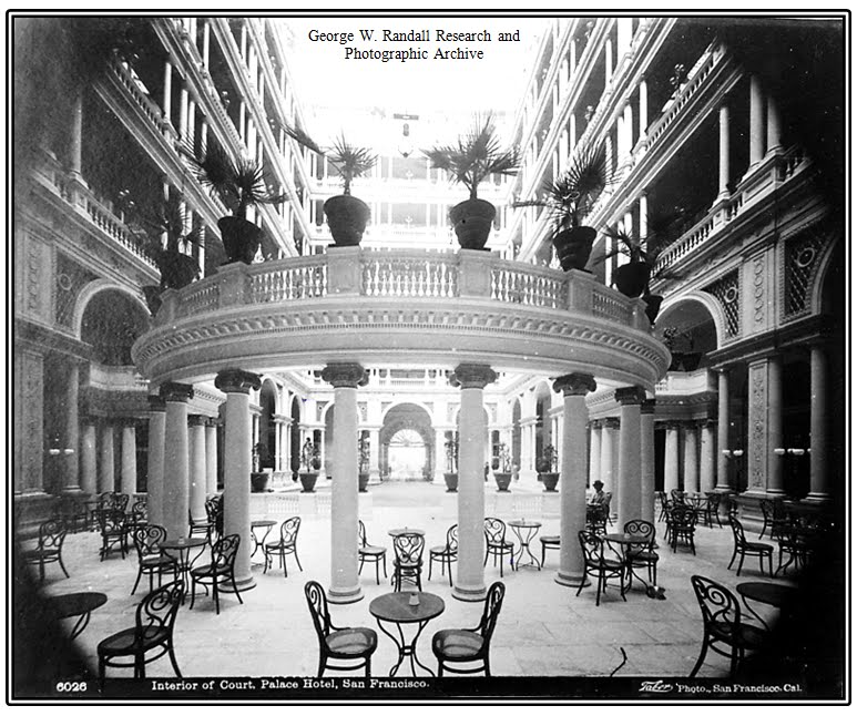
PALACE HOTEL, SAN FRANCISCO
Album XIX * Image 13 * Size 9½ x 7½ inches
Original photograph by Taber, San Francisco Number 6026
Original photograph by Taber, San Francisco Number 6026
The Palace Hotel's Garden Court Entrance, visible through the
pillars,
led into a stunning seven story high atrium.
led into a stunning seven story high atrium.
Inspired by the dream of San Francisco businessman, financier and visionary William “Billy” Chapman Ralston (1826-1875) the 755 guest room Palace Hotel, “occupying an entire block of nearly two acres in downtown San Francisco” opened its doors in October 1875 “to great acclaim.”
In 1864 Kansas born Ralston was co-founder with New York born Darius Mills, (1825-1910) of the Bank of California , the first commercial bank in the Western United States and second richest in the nation at the time. Not only a banker, Mills was a prominent philanthropist and “for a time California’s wealthiest citizen.”

For his dream to turn San Francisco from a gold boom town - (the California Gold Rush 1848-1855) - into a booming metropolis “by erecting a hotel of timeless elegance and unprecedented luxury” Ralston chose Irish born, John P. Gaynor, New York's leading architect.
Ralston and his business partner, William Tang Sharon, (from 1875 Republican Senator for Nevada), commissioned the very best architectural expertise “to study Europe’s finest hotels and make them pale in significance” to Ralston’s dream.
Barely five weeks before the hotel’s grand opening Ralston was finally made aware “the $5 million cost” “would exhaust his banking empire (and) ... the Bank of California would close.” The next day, the 27th of August 1875 Ralston’s body was discovered floating in San Francisco Bay.

 |
| At the time of its opening in 1875 the Palace Hotel was the largest and most costly to build \in the world. |

 Undeterred by his partner’s tragic demise, Senator Sharon, (1821-1885), a real estate agent and, from 1864, manager of the Virginia City branch of the Bank of California, as “main beneficiary of Ralston’s assets”, oversaw the completion and grand opening of the 120 foot high Palace Hotel on the 2nd of October 1875.
 Guest's carriages entered through the Grand Garden Court entrance where five hydraulic elevators carried them and their luggage effortlessly to the hotel’s seven floors where each room was equipped with a fireplace, air conditioning and a call button to speedily summon the last word in service!
For guests - and passersby – the hotel
incorporated the added convenience of a ticket office of the Overland Railroad on its Market and New
Montgomery Street corner.
April 1906 brought disaster ... ... ...

At 5.12 am. on Wednesday the 18th of April 1906 a five mile deep, 7.9 magnitude earthquake struck the San Francisco Bay Area. The Palace Hotel survived but was destroyed in the ensuing fire which engulfed the city leaving it a burnt out shell.
But, like a Phoenix, after three years of restoration Palace Court opened its doors again. With the demise of horse drawn carriages and advent of motor vehicles the original carriage entrance was transformed into The Garden Court, “recognised as one of the world’s most beautiful public spaces.”

One of a series of hand-coloured
design plans submitted for the Central Court
of the Palace Hotel by architect, John P. Gaynor.
of the Palace Hotel by architect, John P. Gaynor.

Extract from: “San Francisco – the Bay and its Cities”
American Guide Series - Published 1940
American Guide Series - Published 1940


INTERIOR OF COURT, PALACE HOTEL,
SAN FRANCISCO
SAN FRANCISCO
Album
XIX * Image 13 * Detail from full size
9½ x 7½ inches
Original photograph by Taber, San Francisco Number 6026

 From: San Francisco - The Imperial City 1899.
Highly Recommended Reading - Google :


Highly Recommended Reading - Google :
HOTEL DEL MONTE, MONTEREY, CALIFORNIA
 |
HOTEL DEL MONTE, MONTEREY, CALIFORNIA
Album XIX * Image 14 * Size 12 x 8 inches
Original photograph by Taber, San Francisco Number 101
The Hotel Del
Monte, Monterey, was opened on the 10th of June 1880 by American
railroad executive, fifty-seven year old Charles Crocker, a founding father of
the Central Pacific Railroad, who along with three other extremely wealthy railway
tycoons; Amasa Leland Stanford;
Collis P. Huntington and Mark
Hopkins commissioned building the hotel set in its own landscaped 126 acre
park overlooking Monterey Bay on California’s Pacific Ocean coast, only 3½
hours
south by rail from San
Francisco. Open all year round the Del Monte was acclaimed
“to be the most
elegant seaside resort in the world.”
Soon after
opening a further 7,000 acres was added “being reserved especially as an adjunct
… through which twenty-five miles of splendid macadamised roadway skirting
the Ocean Shore and passing through extensive forests of spruce, pine, oak
and cypress trees, and is within a quarter of a mile of the pure white
sand beach which is unrivalled for bathing purposes.”
Charles Crocker
died at the hotel on Tuesday the 14th of August 1888 two years after
being seriously injured in a carriage accident in New York, his home city.
|
 |
HOTEL DEL MONTE, MONTEREY, CALIFORNIA
Original photograph by Taber, San Francisco Number 101Album XIX * Image 14 * Detail from full size 12 x 8 inches |
 Catering for up to four hundred guests, Catering for up to four hundred guests, opening charges were: $3 per day or $17.50 for the week.
As the first true resort with its parkland, polo grounds, race track, golf course, boating lake,
heated swimming baths (see Image 15) plus beautiful drives to Cypress Point (see Image 16), Pacific Grove Retreat and Point Lobos Hotel Del Monte was an immediate success, becoming popular with the wealthy and influential of the day, including, Nobel Prize winning author Ernest Hemingway, Theodore Roosevelt America’s 26th president and a galaxy of early Hollywood stars.
|
 |
HOTEL DEL MONTE, MONTEREY, CALIFORNIA
Original photograph by Taber, San Francisco Number 101Album XIX * Image 14 * Detail from full size 12 x 8 inches |
This
area of the landscaped garden is depicted in the sketch below from:
"Mexico, California and Arizona" by William Henry Bishop published by Harper - 1900.
 |
| From: “Mexico, California and Arizona” by William Henry Bishop published by Harper 1900. |

Capable of
accommodating 400 guests the original three story hotel was built entirely of
timber
in “modern
Gothic” style and measured 385 feet in length.
This Ground
Floor Plan includes the immediate landscaped gardens.
Staff quarters
were immediately behind the kitchens.

The hotel caught fire on Friday the 1st of April 1887, and was damaged in the San Francisco earthquake of 1906 in which two people died.


The Hotel Del Monte Golf Course opened in 1897 as an eight hole course;
it was increased to eighteen holes in 1903.
The course today is played under the rules of the United State Golf Association.
Image from: “Monterey Peninsula’s Sporting Heritage” John W Frost Published 2007
it was increased to eighteen holes in 1903.
The course today is played under the rules of the United State Golf Association.
Image from: “Monterey Peninsula’s Sporting Heritage” John W Frost Published 2007

 |
| A
1911 Advertisement for the hotel in which comparisons between the scenic beauty
of Monterey and the Italian Riviera continued to be promoted to the full. + + + + + * + + + + + |
The hotel was again destroyed by fire on the night of Saturday the 27th of September 1924.

The fire of September 1924.
Two years following the second fire, which totally destroyed the hotel façade
(lobby, verandah, billiard room and parlour), a third Hotel Del Monte was constructed
in a “Spanish Style” designed by Lewis Hobart and Clarence Tantau Snr.
The surviving wooden buildings to the rear were covered in stucco and re-roofed with red tiles.
In 1943 the hotel was used as a World War II Navy training school.
In 1947 the Navy purchased the hotel and its 627 acres for $2,130,000.


The fire of September 1924.
From: “Images of
America – Monterey’s Hotel Del Monte” by Julie Cain * Published
by Arcadia 2005
ISBN
0-7385-3032-8


<> <> <> <> <> <> <> <> <> <> <> * <> <> <> <> <> <> <> <> <> <> <>

Album XIX * Image 15 * Detail from full size 9½ x 7½ inches
Original photograph by Taber, San Francisco Number B2257
As the hotel was
the product of four wealthy railroad tycoons it is not surprising
it should have been serviced by two passenger stops.
The primary station served the hotel itself,
whilst the second, the “Del Monte Bath House”,
allowed passengers direct access
to the luxurious bathing facilities and gardens by the beach.

Album XIX * Image 15 * Detail from full size 9½ x 7½ inches
Original photograph by Taber, San Francisco Number B2257
Records indicate the bath house itself “sat across the railroad tracks” on “24 acres of beachfront property with a pier and saltwater pump situated in Monterey Bay, … and incorporated a mix of interior baths, a large heated saltwater pool, changing stalls and a small restaurant;
ocean swimming facilities were also included.”

Album XIX * Image 15 * Detail from full size 9½ x 7½ inches
Original photograph by Taber, San Francisco Number B2257
The pool was damaged and remained closed for twelve months following the 1906 San
Francisco Earthquake which destroyed the hotel.
It re-opened in 1907 following “massive renovation and expansion to the facility.”
The bath house closed following the second hotel fire in September 1924;
itself succumbing to fire in 1930.


Overview of Hotel Del Monte in relation to the Bath House and Monterey Bay.
Santa Cruz
Trains: Railroads of the Monterey Bay
http://www.santacruztrains.com/feeds/posts/default?alt=rss
<> <> <> <> <> <> <> <> <> <> <> * <> <> <> <> <> <> <> <> <> <> <>

Album XIX * Image 16 * Size 9½ x 7½ inches
Original photograph by Taber, San Francisco Number B2498
 Shortly after
the grand opening of the luxurious Hotel Del Monte set in its own 126 acres of
magnificent landscaped acres on the 10th of June 1880 a further
7,000 acres was added and “twenty-five miles of splendid
macadamised roadway skirting the Ocean Shore laid for the amenity of its affluent guests.”
Shortly after
the grand opening of the luxurious Hotel Del Monte set in its own 126 acres of
magnificent landscaped acres on the 10th of June 1880 a further
7,000 acres was added and “twenty-five miles of splendid
macadamised roadway skirting the Ocean Shore laid for the amenity of its affluent guests.” This very soon became one of California’s most celebrated scenic roads as it skirted the Pacific Ocean shore passing “through extensive forests of spruce, pine, oak and cypress trees, within a quarter of a mile of the pure white sand beach which is unrivalled for bathing purposes.”
Taking a full day, horse drawn carriages departed the hotel
taking guests on one of the most picturesque scenic tours along America’s west
coast, known as the Seventeen
Mile Drive,
all along which “rare Monterey cypress trees so gnarled and twisted that (Scottish novelist and
all along which “rare Monterey cypress trees so gnarled and twisted that (Scottish novelist and
travel writer) Robert Louis Stevenson
described them as 'ghosts fleeing before the wind.’”
The section of the route depicted in Image 16 was known as “The Loop".
Set in dramatic
scenery Cypress Point is today a private eighteen-hole golf club.
 |
| From: "Abroad and at Home and " by Morris Philips 1891 |
<> <> <> <> <> <> <> <> <> <> <> * <> <> <> <> <> <> <> <> <> <> <>

Album XIX * Image 17 * Size 9½ x 7½ inches
Original photograph by Taber, San Francisco Number B2499
 |
| The Seal Rocks near
Cliff House, San Francisco Taber Photo. California B2191 |
Seal
Rocks, and the nearby Bird Rock
240 yards north, lie off a sandy beach at the
mouth of Seal Rock Creek along Monterey Peninsula’s coastal “Seventeen Mile
Drive”.
During the breeding season the rocks are used by the northern fur seal, (Callorhinus ursinus), when the pups are born following a gestation period of one year. Male fur seals are over one third longer than females and over four times heavier.
During the breeding season the rocks are used by the northern fur seal, (Callorhinus ursinus), when the pups are born following a gestation period of one year. Male fur seals are over one third longer than females and over four times heavier.

<> <> <> <> <> * <> <> <> <> <>
YOSEMITE VALLEY CALIFORNIA

STONEMAN HOUSE, HALF-DOME AND NORTH-DOME A.D. 1890
Album XIX * Image 18 * Size 9½ x 7½ inches
Original photograph by Taber, San Francisco Number 5175
Album XIX * Image 18 * Size 9½ x 7½ inches
Original photograph by Taber, San Francisco Number 5175
Because
leaseholds were only granted for a maximum term of ten years many Yosemite
Valley hoteliers were reluctant to make the on-going investment for repairs and
improvements because of the uncertainty their lease would be renewed.
 |
STONEMAN HOUSE, HALF-DOME AND NORTH-DOME A.D. 1890
Album XIX * Image 18 * Detail from full size 9½ x 7½ inches
Original photograph by Taber, San Francisco Number 5175
For this
reason in 1885 California’s State Legislature appropriated $40,000
for construction
of a 150 guest hotel to be named Stoneman House,
named after U.S.
Army cavalry officer George Stoneman.
Stoneman, who rose to the rank of major general was Democratic governor of California from 1882-1886. He died following a stroke in September 1894 aged seventy-two.
|

fineartsamerica.com
The demand for
more suitable accommodation than the very first hotels in Yosemite was
Met in 1887 with
the opening of the four-story, 150 bedroom Stoneman House,
following the
appropriation of $40,000 by the State Legislature specifically for that
purpose.
A further $5,000
was available for furniture and water supply.
The contract was
given to Carle, Croly & Abernethy, the lowest bidders at $38,975 and the
hotel welcomed its first guests in 1887 under the management of Mr. J. J. Cook,
previously manager of Black’s Hotel, near the site of the present Four-Mile
Trail to Glacier Point.
With the opening
of Stoneman House Blacks was demolished in 1888 as there was
“a unanimity of
feeling (among the commissioners) that the old shanties and other
architectural
bric-a-brac had done their service and should be torn down.”
The new hotel
was described as a “bulky structure, not beautiful architecturally,
and (within) the
first few years of its existence demonstrated that its design was faulty.”
In 1896, still
under the management of Mr. Cook on an annual lease of $1,200
Stoneman House was
destroyed by fire.

Reference:
<> <> <> <> <> <> <> <> <> <> <> * <> <> <> <> <> <> <> <> <> <> <>

Detail from the badly damaged. unprotected sand previously folded
colour photograph measuring 34½ 17½ inches.

NORTH AND SOUTH DOME AND STONEMAN HOUSE
FROM SOUTH WALL, YOSEMITE VALLEY 1894
FROM SOUTH WALL, YOSEMITE VALLEY 1894
Album XIX * Image 19 * Size 9½ x 7½ inches
Original photograph by Taber, San Francisco Number 8591
<> <> <> <> <> <> <> <> <> <> <> * <> <> <> <> <> <> <> <> <> <> <>

Full view of a badly damaged, unprotected and folded
colour photograph measuring 34½ 17½ inches.

<> <> <> <> <> <> <> <> <> <> <> * <> <> <> <> <> <> <> <> <> <> <>

Digital photograph taken November 2011.
NORTH AND SOUTH DOME AND STONEMAN HOUSE (the roof-line just visible)
FROM SOUTH WALL, YOSEMITE VALLEY 1894
Full view of a badly damaged, unprotected and folded
colour photograph measuring 34½ 17½ inches.

Digital photograph taken November 2011.
NORTH AND SOUTH DOME AND STONEMAN HOUSE (the roof-line just visible)
FROM SOUTH WALL, YOSEMITE VALLEY 1894
colour photograph measuring 34½ 17½ inches.
<> <> <> <> <> <> <> <> <> <> <> * <> <> <> <> <> <> <> <> <> <> <>
 |
| CATHEDRAL SPIRES 2660 FEET, YOSEMITE VALLEY 1894
Album XIX * Image 20 * Size 9½ x 7¾ inches
|
<> <> <> <> <> <> <> <> <> <> <> * <> <> <> <> <> <> <> <> <> <> <>
 |
| THREE BROTHERS
SHOWING MERCED RIVER. YOSEMITE VALLEY 1894Album XIX * Image 21 * Size 9½ x 7¾ inches
Original photograph by Taber, San Francisco Number 6606
|
<> <> <> <> <> <> <> <> <> <> <> * <> <> <> <> <> <> <> <> <> <> <>

GLACIER POINT, 3300 FEET AND SOUTH DOME. YOSEMITE VALLEY 1894
Album XIX * Image 22 * Size 9½ x 7¾ inches
Original photograph by Taber, San Francisco Number 6602
Original photograph by Taber, San Francisco Number 6602
Located on the
south side of Yosemite Valley, Glacier Point offers breath taking views of many
of the landmark features within the 1,170 square mile National Park,
of the landmark features within the 1,170 square mile National Park,
including Nevada, Vernal (image 24) and Yosemite waterfalls (image 25)
and the most distinctive rock, the 2,000 sheer cliff face of Half Dome.
The original four mile trail from Yosemite Valley to Glacier Point
was completed in 1872 by John Conway. and cost at the time $3,000.
The following year a California '49er and cattle rancher named Charles Peregoy
constructed the Mountain View House Hotel for the convenience of travellers on
the Wawona to Yosemite Valley Trail. In 1878 Irishman James McCauley,
who acquired Pergoy's unfinished trail later selling it to the state of California for $2,500,
had a two story hotel named Mountain House at Glacier Point.

 GLACIER POINT, 3300 FEET AND SOUTH DOME. YOSEMITE VALLEY 1894 Album XIX * Image 22 * Detail from full size 9½ x 7¾ inches
Original photograph by Taber, San Francisco Number 6602
The granite rock outcrop at Glacier Point where visitors
in the past not only sat but did
hand and one leg stands, as in this famous silhouette photograph, right, by George Fiske of Kitty Tatch and
her friend Katherine Hazelston, waitresses at Yosemite’s Sentinel Hotel posing
on the overhang in the early 1890’s, or the group of daredevils below, titled “Living
on the Edge” as they too pose apparently unconcerned about the 3,254 foot drop to
the valley floor!

historybyzim.com
Today a sign reads:
“DO NOT ATTEMPT SUCH FOOLHARDY STUNTS! YOU WILL
DIE!”


Venturing onto the overhanging rock
outcrop at Glacier Point
was not for the faint-hearted as one false step would result
in a fall “nearly a mile straight down.”
was not for the faint-hearted as one false step would result
in a fall “nearly a mile straight down.”
Yosemite Park
became America’s third national park
on the 1st of October 1890
on the 1st of October 1890
with
Glacier Point one of its top attractions as it
offered a panorama view of Yosemite Valley.
offered a panorama view of Yosemite Valley.
Venturing out
onto Overhanging Rock,
with its sheer drop of 3,254 feet, was a favourite
with its sheer drop of 3,254 feet, was a favourite
for
courageous but foolhardy Victorian visitors and photographers with their
heavy tripod and plate camera.
<> <> <> <> <> <> <> <> <> <> <> * <> <> <> <> <> <> <> <> <> <> <>

ON THE TRAIL TO NEVADA FALLS YOSEMITE VALLEY APRIL 1895
Album XIX * Image 23 * Size 9½ x 7¾ inches
Original photograph by Taber, San Francisco Number 6954
In 1895 almost 95% of Yosemite National Park was an undeveloped
wilderness.
This is the Stairway on Clouds Rest Trail.
This is the Stairway on Clouds Rest Trail.
Clouds Rest is a
mountain in Yosemite National Park, access to its 9,926 foot summit is along a
14½ mile trail part of which in the 19th century involved
negotiating this stairway.

ON THE TRAIL TO NEVADA FALLS YOSEMITE VALLEY APRIL 1895
Album XIX * Image 23 * Detail from full size 9½ x 7¾ inches
Original photograph by Taber, San Francisco Number 6954

Highly recommended read:
The Treasures of the Yosemite - The Century
Magazine
Vol. XL No.4 August
1890
 |
| ON THE TRAIL TO NEVADA FALLS YOSEMITE VALLEY APRIL 1895
Album XIX * Image 23 * Detail from full size 9½ x 7¾ inches
 NORTH AND SOUTH DOME AND STONEMAN HOUSE (roof-line just visible) FROM SOUTH WALL, YOSEMITE VALLEY 1894 
VERNAL AND NEVADA FALLS FROM GLACIER POINT,
YOSEMITE VALLEY APRIL 1894
Album XIX * Image 24 * Size 9½ x 7½ inches
Original photograph by Taber, San Francisco Number 8955
  <> <> <> <> <> <> <> <> <> <> <> * <> <> <> <> <> <> <> <> <> <> <> |
 |
UPPER AND LOWER YOSEMITE FALLS, YOSEMITE VALLEY APRIL 1894
Album XIX * Image 25 * Size 9½ x 7¾ inches
Original photograph by Taber, San Francisco Number 8955
|
<> <> <> <> <> <> <> <> <> <> <> * <> <> <> <> <> <> <> <> <> <> <>

BRIDAL VEIL FALLS HEIGHT 860 FEET.
VIEW FROM THE DRIVEWAY
YOSEMITE VALLEY APRIL 1895.
Album
XIX * Image 26 * Size 9¼ x
7¾ inches.
Original photograph by Taber, San Francisco Number 6973
<> <> <> <> <> <> <> <> <> <> <> * <> <> <> <> <> <> <> <> <> <> <>

UPPER YOSEMITE FALLS, 1,502 FEET.
YOSEMITE VALLEY. APRIL 1895
Album XIX *
Image 27 * Size 9¼ x 7¾ inches.
Original photograph by Taber, San Francisco Number 6963
<> <> <> <> <> <> <> <> <> <> <> * <> <> <> <> <> <> <> <> <> <> <>

MIRROR LAKE YOSEMITE VALLEY 1897
Album XIX * Image 28 * Size 9½ x 7½ inches.
Original photograph by Taber, San Francisco Number 3043
<> <> <> <> <> <> <> <> <> <> <> * <> <> <> <> <> <> <> <> <> <> <>

YOSEMITE STAGE BY FALLEN MONARCH, MARIPOSA GROVE 1894
Album XIX * Image 29 * Size Size 9½ x 7½ inches.
Original photograph by Taber, San Francisco Number 6619
The Fallen Monarch is estimated to have fallen over three hundred years ago.
The Mariposa
Grove of Giant Sequoias, which includes Grizzly Giant, (Image 31)
was discovered
by Canadian Galen Clark (1814-1910) in 1857.
He was an
important figure in gaining legislation to protect the Grove and Yosemite
serving as Guardian
of Yosemite National Park for twenty-four years.

YOSEMITE STAGE BY FALLEN MONARCH, MARIPOSA GROVE 1894
Album XIX * Image 29 * Detail from full size Size 9½ x 7½ inches.
Original photograph by Taber, San Francisco Number 6619

YOSEMITE STAGE BY FALLEN MONARCH, MARIPOSA GROVE 1894
Album XIX * Image 29 * Detail from full size Size 9½ x 7½ inches.
Original photograph by Taber, San Francisco Number 6619
<> <> <> <> <> <> <> <> <> <> <> * <> <> <> <> <> <> <> <> <> <> <>

SECTION OF "WAWONA" 285 FEET DIAMETER, 275 FEET HIGH
Album XIX * Image 30 * Size 9¼ x 8 inches.
Album XIX * Image 30 * Size 9¼ x 8 inches.
Original photograph by Taber, San Francisco Number 3049
Twenty-eight feet in diameter, 275 feet tall* with an estimated age of
2,300 years “Wawona”
was a famous giant
sequoia, (Sequoiadendron giganteum), in
the Mariposa Grove of Yosemite National Park. Under an exceptionally heavy snow
load in 1969 “Wawona” succumbed and fell.
* These are the dimensions on the photograph. Today the official
dimensions are given as:
227 feet in height and 26 feet in diameter at the base with an estimated age of 2,300 years.

SECTION OF “WAWONA” 28 FEET DIAMETER, 275 FEET HIGH
Album XIX * Image 30 * Detail from full size 9¼ x 8 inches.
Original photograph by Taber, San Francisco Number 3049

In 1881* despite
a slight lean, which increased afterwards,
the
Yosemite Stage and Turnpike Company
instructed
three brothers called Scribner,
(who were paid 75 dollars, equivalent to 1,947 dollars
or 1,500 UK pounds in 2018),
to
enlarge an existing scar caused by fire and tunnel
through
proved immensely popular.”
of the the internal combustion engine, drive through
the twenty-six foot tunnel in motor cars.
The February snow of 1969 deposited an estimated
two tons of snow on the crown of the tree, this top heavy weight brought “Wawona” crashing to the ground where it remains to this day providing habitat for all forms of wildlife and providing a foundation for new plant growth.
* NOTE: The date June 1878 is also given.

<> <> <> <> <> <> <> <> <> <> <> * <> <> <> <> <> <> <> <> <> <> <>

GRIZZLY GIANT, MARIPOSA GROVE 1894
Album XIX * Image 31 * Size 9¼ x 7¾ inches.
Original photograph by Taber, San Francisco Number 6610

* NOTE: In 2019 refined scientific dating methods resulted in a new age estimate for the


Original photograph by Taber, San Francisco Number 6610
Its age estimated at 2,995 years* the Grizzly
Giant is a giant sequoia in
Mariposa Grove in California’s Yosemite National Park,
Mariposa Grove in California’s Yosemite National Park,
it was last measured in 1990 by “Big Tree Hunter” Wendell D. Flint.
Its trunk
has a volume of 34,005 cubic feet making it the 25th largest giant
sequoia living today.

* NOTE: In 2019 refined scientific dating methods resulted in a new age estimate for the
Grizzly Giant 2,995 years old – plus or
minus 250 years.
Source: Yosemite National Park Website.
Reference: JSTOR
Vol. 47 No. 1.
Estimated Ages of Some Large Giant Sequoias: General Sherman
Keeps Getting Younger. Nathan L.
Stephenson, Western Ecological Research Center, Sequoia and
Kings Canyon Field Station, Three
Rivers, California.


<> <> <> <> <> <> <> <> <> <> <> * <> <> <> <> <> <> <> <> <> <> <>

YOSEMITE STAGE BY FALLEN MONARCH, MARIPOSA GROVE 1894
Album XIX * Image 31 * Detail from full size 9½ x 7½ inches.
Original photograph by Taber, San Francisco Number 6619
Original photograph by Taber, San Francisco Number 6619

YOSEMITE STAGE BY FALLEN MONARCH, MARIPOSA GROVE 1894
Album XIX * Image 31 * Detail from full size 9½ x 7½ inches.
Original photograph by Taber, San Francisco Number 6619
Original photograph by Taber, San Francisco Number 6619

YOSEMITE STAGE BY FALLEN MONARCH, MARIPOSA GROVE 1894
Album XIX * Image 31 * Detail from full size 9½ x 7½ inches.
Original photograph by Taber, San Francisco Number 6619
Original photograph by Taber, San Francisco Number 6619
<> <> <> <> <> <> <> <> <> <> <> * <> <> <> <> <> <> <> <> <> <> <>

“VIRGINIA AND MARYLAND” 27 FEET DIAMETER, MARIPOSA GROVE
Album XIX * Image 32 * Detail from full size 11½ x 8 inches.
Original photograph by Taber, San Francisco Number A269
Original photograph by Taber, San Francisco Number A269
The Giant Sequoia
“Virginia” measured 89.3 feet circumference at its base
with a diameter of 28.4
feet. Its diameter ten feet above ground is recorded at
18.4 feet, its height
being 186 feet.

<> <> <> <> <> <> <> <> <> <> <> * <> <> <> <> <> <> <> <> <> <> <>
George W. Randall Research and Photographic Archive
END OF ALBUM XIX
<> * <><> * <> + <> * <><> * <>
POSTED FRIDAY 1st NOVEMBER 2019


REVIEWED 28 MAY 2024